Pine Woods Trail – August 23, 2020
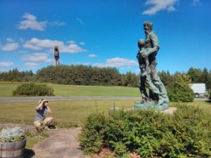
Pine Woods Trail, Mendon Ponds County Park, 1.5 miles – this is a small loop trail in the NE corner of Mendon Ponds park.
Read more of yon fair adventuresPine Woods Trail, Mendon Ponds County Park, 1.5 miles – this is a small loop trail in the NE corner of Mendon Ponds park.
Read more of yon fair adventures
Nathan had hurt his ankle a little bit, so I asked Levi if he just wanted to do some geocaching. He agreed, and I decided to just look for a place on the map it seemed like it had a whole bunch of geocaches that we could easily get to and still walk around without needing to expect a “hike”. What I ended up finding was a golf course that is now owned by the town of Penfield, Shadow Pines. It’s entirely undeveloped; that is, it’s just basically been let go from being a golf course and has been minimally maintained, but there are no real new facilities. Penfield apparently has a new master plan to develop the site, but no work has been done yet.
Check it outMan. March in western NY is way freaking colder than in California. Not that I miss it or anything. Wait now… Anyway. Packed the first box today…I mean, moving in like 6-10 weeks, so, sure. Why not. The owner of our current rental has been getting it painted for the last week, so it’s looking all new and fresh. Anyway, time to delve into the past, for a good day out in the Santa Monica Mountains.
We had a day! I’m not sure how I picked these places (…I’m not even 100% sure I picked them in advance), but either way, Nathan and Greg and I headed out to some of the various parks in an around Malibu (fine, closer to Agoura Hills…), as most of the Angeles were still closed off after the Station Fire. We hit up Paramount Ranch (which is actually part of the Santa Monica Mountains NRA), and Malibu Creek State Park. Afterwards we got some food and beer, and all in all had a pretty fine. day.

Well, I’ve enjoyed geocaching a bit ever since I got my GPS a few years back, but it’s generally been something I’ve done as an add-on to hiking, or finding the occasional urban cache. But one day this gentleman Tobias sent out mail to the Caltech Alpine Club asking if anyone wanted to go out for an actual day of geocaching, and I went. Erin came as well, and we went around to several places that I probably would not have stopped to look at otherwise.

Not so much of a problem today.
For the holidays (pick your favorite, but it was probably Hannukkah for my family), I got a new GPS toy! (the garmin etrex venture Cx, very shiny). So I had to go out and play with it. I’d gone geocaching once with a couple of friends, which it looks like I never wrote up, but I thought it would be fun to go play. Admittedly, I mostly wanted to use the GPS for mapping, but it seemed a reasonable thing to go do.
As it was two days before Christmas, everyone and their mother was gone, so I decided to play it fairly safe and do a really short, really close little hike. After looking through my Trails of the Angeles (now getting well worn!), I decided that Grizzly Flat would be ideal. It’s more or less the first trailhead up Route 2, so only about 8 miles from the freeway, and is less than 5 miles total, and checking at geocaching.com informed me that there were 3 caches on the route, so off I went. So, I walked ~5 mi total (both parts) and a few hundred feet of gain and loss, but nothing crazy.