The Angeles Crest Highway (Route 2) up and through the San Gabriel Mountains has a fairly convoluted history of being open and closed in various places, at various times, for various reasons. For most of time in Pasadena, at least some of it had been closed, and I had never driven the entirety of the road. One particular section, from Islip Saddle to Vincent Gap, had been closed for several years, and while I had been right up to either end of that closure, I had never gone through that middle section. So, when I heard it was open, it seemed like the right time to head up there for a hike. There aren’t actually that many trailheads heading out from that section, but there are a couple leaving from Dawson Saddle, which is also the highest point on the ACH at 7901′. Joe and I ended up heading to Throop Peak, which has the added amusement value of being named after Amos Throop, the man who founded Caltech. The hike was fairly brief at 5 miles and 1200′ of gain, but it was a nice day, and we managed to do a complete loop from Pasadena to trailhead to Pasadena. And with hindsight and the Station Fire messing everything up again, it was good that we grabbed the opportunity.

I look pretty good there, if I do say so myself
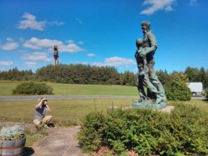
Anyway. We drove up ACH from the west, and had a nice drive up, enjoying the forest, heading through the tunnels and whatnot, and being very happy to see the gate open at Islip Saddle. We continued on from there until we got to the saddle, where we stopped to take a few pictures (as above) – so as to commemorate actually having been there. Yee-haw!
We started up the trail, at which a sign helpfully informed us had been built by boy scouts in 1982 for the 75th anniversary of world scouting. It’s a pretty mellow trail, not too much to say about the journey itself, just a fairly standard walk up a hill in the San Gabriels. It meets up with the PCT at some point along the way, and heads a total of 2.5 miles up to the summit at 9136′.
There is a plaque up there dated 1992, mentioning Amos Throop, founder of Throop University, aka Caltech. There were some other people at the summit, who I think we talked to for a for a few minutes. There was a quite good view at the summit along the north-south ridgeline, where you could clearly see the differences in flora on the opposite faces. Really brings home how much the difference in water matters. Took us about 2.5 hours to do the whole thing, not rushing, taking a bunch of photos, and continuing with my “2 mi/hour” general average. After finishing, we then drove out of the east side, marking the only time to date I can remember that I had driven the entire Angeles Crest.

It was really awesome to see the gate open

Joe and I at the summit.

The plaque at our feet (I keep trying to typo that as plague. Whatever floats your boat.)

Miscellaneous people at the summit.

Here you can get that view I was talking about with the north face / south face effect that you get in the San Gabriels, due to it being an east-west range. (Also, that’s some nice haze in the background)