In my ongoing quest to hit up all NPS properties (whee), I went to Pinnacles NM with a whole mess of people from February 24-26 (we had originally been intending to go to Death Valley, but that’s a whole different story). This is a grouping of volcanic rocks which have meandered their way northward over the last thousand or so years, ending up about 1-1.5 hours south of San Jose, in the Gabilan Mountain Range.
(eta 2/28/2014: Pinnacles is now a National Park!)

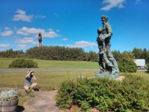
such a stereotypical yet awesome image!
We stayed at Pinnacles Campground which at the time was just outside the monument, but has since become part of the monument lands. We got there Friday evening, and set up, and had a bunch of food, and generally enjoyed each other’s company. It was pretty dark out, and we really couldn’t see a thing, so we had to wait until the morning to look around.
But our group campsite in the morning looked pretty innocuous.

We had spent a really cold night, however, much to my surprise, as I had a +15 sleeping bag, sleeping pad, some clothes, etc, etc. The morning sun also let us determine what had been going on though.

just a wee bit nippy
I’m an early riser, and no one was up, so I decided to take a walk over to the monument, which is really just right next door. You walk to the end of the campground, and there is a gate that leads onto the property.

I walked about a mile along the Bench Trail, basically paralleling the road, until I got to a viewing site/parking lot, with the first real view of the volcanic rocks which give Pinnacles its name:

Then I walked it back to camp, where people were starting to get up, and have breakfast, and generally getting ready to get on with our day. We then all piled into a pair of cars, and drove the ~2 miles down the road (heh) to the point where I had hiked that morning, the Peaks View picnic area.
We headed north on the Bench Trail until we met up with the Old Pinnacles Trail, and just kept going north on that until we hit the Balconies Caves, stopping a bunch to look at rocks and take pictures along the way.

As you approach the caves, the route (as you might expect) grows way more rocky, and you turn your way into a slot canyon before getting to the cave area.

pretty!

better bust our your headlamps!!

beware!
going through the caves was pretty awesome. Although, you know, dark. But a nice good scramble, and such a sudden change from the bright and warm of outside. Being, you know, dark and cool. Verging on cold. I really wish I had a burlier headlamp. Oh yeah. Light in the darkness, I am.
Anyway, we stopped near this useless little bridge shortly after the caves, and sat in a nice spot of grass and had us some lunch.

At this point, our group of people split into two, one group which wanted to cut back home the way we had come, and set stuff up for dinner, while the rest of us continues on a large loop through the monument. We went down from the caves to the ranger station on the west side of the monument (we had started on the east side), and then continued on the Juniper Canyon Trail up over the crest of the pinnacles, and took a right in the trail to hit up Scout Peak, at 2651′.

heading down to the ranger station

watson on a rock near the top

view to the east
We then just sort of hoofed it down the mountain, and kept trudging on, until we made it back to the east side ranger station, watching some climbers on the way, until we made it back to the east side ranger station (the closest climbing area is known as “tourist trap'” heh). We talked to the rangers a little bit, who were pretty cool, as might be expected.
From there, the trail we took cut down to a stream, and we sort of ambled tiredly back to the cars, and then went back the little bit to the campsite.
the total for that loop was about 10 mi, with some amount of climbing I am not quite sure of. Given my additional 2 mile ramble that day, I had a total of 12 miles that day.
The next morning those of us remaining got up and after some breakfast and packing up, we braved the light rain to go visit the Bear Gulch caves. Starting from the eastern ranger station again, we started up the trail we had come down previously, but then cut over to a different bit of trail, to get to the other main set of caves.

look at nim looking at me, but his neck is bent all funny!
These caves are apparently home to many many bats, so there are part of them that are basically locked off from human access. And the interior pathway was done up by the CCC in the 30s, or whenever it was that the CCC was doing its thing, so you have the odd thing of a cut path and clearly defined stairs and railings in what is an awesome natural cave system. You ascend through the caves, and then come out the top, and walk back down the canyon, across which you can see snippets of the caves you just came up through.

wee planties! epiphytes? or something

these trees forgot which way was up!
and then we, you know, went back, and then I drove home, and it was all generally lots of fun.