Today we went and picked up our new canoe! We learned the art of actually tying it to the car, and went out paddling for a few miles. We saw some ducks, swans, a turtle, and some powerboats, and also some nice fall colors, so a totally legitimate breakin ride , I would say. But….somehow we now have to *travel back in time*, to the second day of our time in the Channel Islands, in which there was walking, and foxes!

I am sure there is a view right…over…there
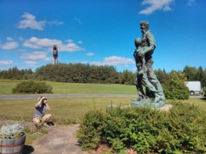
The first day was good! The next day they gave us a truck ride a good chunk up the hill, basically to Black Mountain (maps), so that we’d be able to hike a little farther into the interior. After the bumpy ride up the hill, we set off. We went south on the truck road, stopping to enjoy the scenery, and checking out the site of an historic army camp at the base of a hill. Well, not really checking it out, but you could see the outline of some building structures, and the star shape that had been the base of a flagpole. Jim, that we had met up with yesterday was there for this portion, as well as a father out with his two daughters, that we ended up talking with a bit. I am piecing together pieces of this again, but we kept on going south, skirting past Soledad Peak (a bump on the side of the road that we did manage to “summit”, and catching some really cool glimpses of a pair of island foxes (one of whom was kind enough to pose for us in the middle of the road). Note – the foxes are *supposed* to be the largest land-based mammals there. There was a herd of deer and elk there, raised for hunting purposes (ref here), but they were in the final stages of hunting down the herds, and the prior family owners moving off that summer. I’d love to go back and see it now that they’re gone, but I can get why the family owners were sad to leave. Though really…elk were not meant to live there.)

flagpole base

yes. right there, yes, thank you.

Look, they’re tiny and cute.
As I recall this, we headed along until we got to Radar Mountain, which, true to its name, has a bunch of radar facilities on the top of it. We went up the last bit, scrabbled around, and sat and talked (it was the six people – me, nathan, jim, and the father with his two daughters). While most of the “trail” we took there was this pitted dirt truck road, we had passed a small bit of paved road heading south – apparently it was part of the military installation that they had put in to be able to carry heavy things over it. It was pretty incongruous to see it out in the middle of this otherwise semi-empty island though. How did they even get the paving equipment out to the island?! Enquiring minds want to know. After spending some time up there, we headed back. We took another little spur south off the main trail/road in order to get a good view of the south shore of the island. There was, overall, a pretty fabulous view down south. On the way back, we mostly took the truck road, but at about the point where we had been dropped off, a real trail turns off. We cut off on this trail, which cut through more meadows and hills and made some splits and turns, but mostly went straight to the Cheery Canyon trail, on which we turned, and dropped back to the mouth of the canyon just above the campground.

Seriously – *how did they pave this???*

landscape…so….rumply